Tushar Mountains, east of Beaver
Ski Utah · Brian Head, above Cedar City
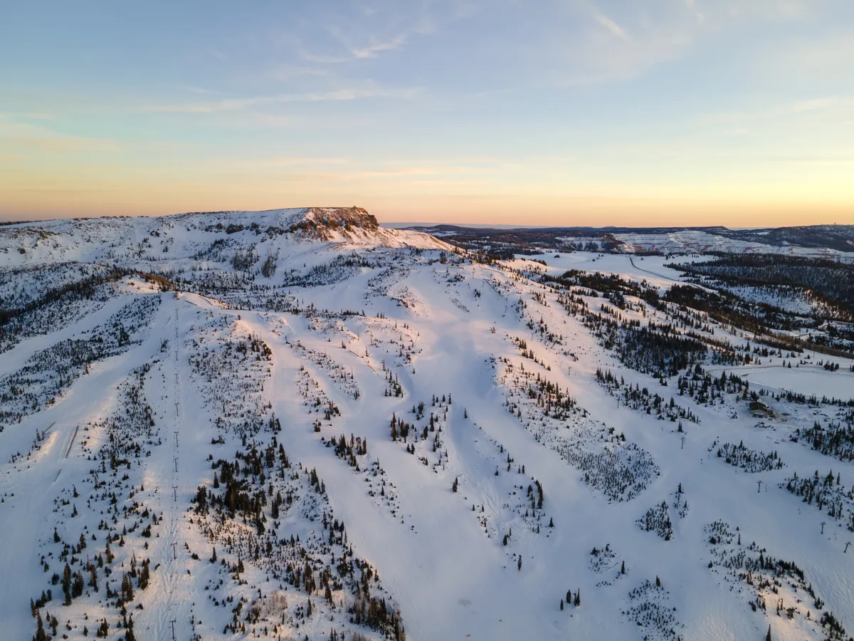
Brian Head Resort
The highest base elevation of any Utah ski resort, on a plateau above Cedar City. It is a Southern Utah ski day you can pair with red rock and Cedar Breaks.
Photo: Jessee Lynch · Courtesy of Brian Head Resort · Used with permission · Brian Head Resort
Plan your visit: access, parking and practical details
Check the operator’s current fees, reservations, parking, transit, restrooms and accessibility arrangements before leaving. Confirm specific mobility or sensory needs directly with the venue.
Official visitor information ↗Snow report
The operator’s conditions page includes weather and webcams. Confirm winter lift operations and the snow report date.
How to read a snow report
- 24-hour / 48-hour snowfall
- New snow over the stated reporting window. The 48-hour total includes the 24-hour window; don’t add them together.
- Base depth
- Snow on the ground at the resort’s reporting location, which can differ from conditions elsewhere on the mountain.
- Season snowfall
- Snow accumulated over the season’s reporting period, rather than the depth currently on the ground.
- Forecast
- A prediction of future snow, separate from measured snowfall. Snowfall alone does not establish which lifts or trails are open.
Use the source’s update date and time zone, especially around overnight storms. Off-season or stale reports may retain old readings. A missing or undated report does not mean no snow.
Brian Head’s base sits at roughly 9,600 feet, which keeps the snow dry even though the resort is far closer to Las Vegas than to Salt Lake City. There are two connected mountains: Giant Steps, with the higher, steeper terrain, and Navajo, a gentler hill that is good for beginners and families. Night skiing, tubing and a strong ski school round it out.
The town is a small cluster of condos and cabins at the top of SR-143, about 30 minutes from Cedar City and next to Cedar Breaks National Monument. Brian Head is part of the Mountain Capital Partners family of resorts.
Maps and mountain orientation
Use the resort trail map to compare base areas, lifts and named runs before setting out. Then check the operator’s mountain report for the lifts and trails scheduled to operate on your visit.
Official resort maps
Find this resort on the Utah and Wasatch locator maps →
Choose your arrival plan
Choose Navajo Lodge for beginner terrain and lessons, or Giant Steps Lodge for intermediate and advanced terrain. The operator lists free, first-come parking at both bases without reservations. The free town shuttle connects the lodges and local accommodations during ski season; Cedar City transfers are separate services from independent operators. Confirm the current shuttle operating dates and final return before relying on it, and check UDOT for road conditions before driving to the resort.
Known for
- Highest base elevation in Utah
- Close to Las Vegas and St. George
- Two connected mountains
- Night skiing and tubing
Good to know
- SR-143 climbs steeply from Parowan. Carry chains or a 4WD/AWD vehicle with snow tires in storms.
- The altitude is high. Drink lots of water and take it easy on the first day if you are coming from sea level.
- Combine it with a trip to Zion or Bryce; both are within a couple of hours.